Geophysical Imaging of the Subsurface
Geophysical methods in general, and seismology in particular provide the tools for non-intrusive characterisation of the upper subsurface, the most critical area of the geosphere for the assessment of the environmental impact of engineering operations.
Seismic methods can be applied even when no activity is involved and no active surveys are performed by analysing the propagation of vibrations from permanent natural or anthropogenic sources, such as noise.
The transmission of waves through the upper layers of the subsurface can be used to image changes in the medium properties such as:
- fluid content and saturation
- presence of fractures or pathways for fluid transmission
- lithological or material changes
- changes in competence
These observations provide a crucial input for applications such as e.g. hydrology and environmental monitoring
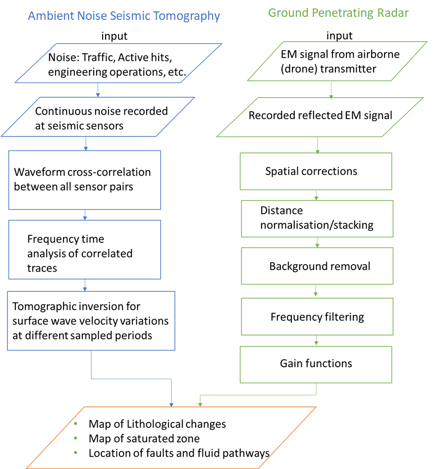
Seismic noise tomography
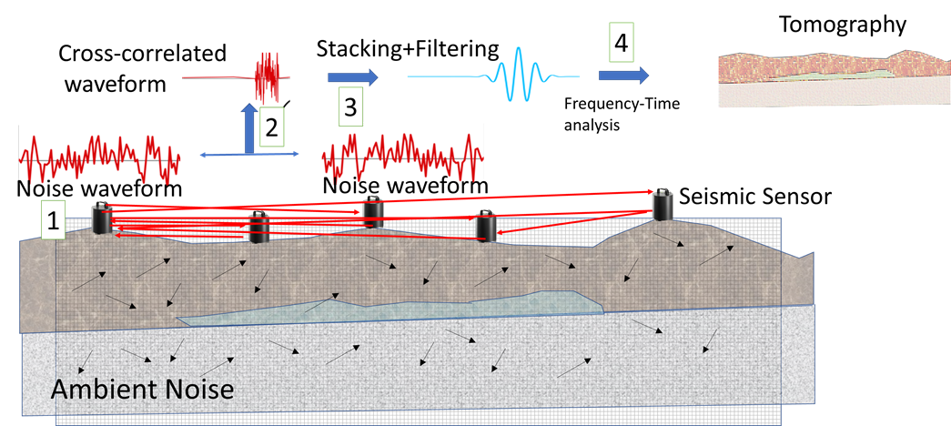
Ambient seismic noise can be used to obtain surface seismic profiles/ reflections in areas where active-source seismic data acquisition may not be feasible due to accessibility or environmental constrains.
The method is based on the use of coherent signals recorded at pairs of seismic sensors to image the underlying structure without the use of earthquakes or explosions use in traditional seismic surveys, making use of available natural or man-made sources such as waves and wind along shorelines engineering operations or traffic noise (“Ambient Noise”).
By cross correlating long time series between sensors, the common signal is retrieved while the incoherent energy cancels out. This leaves a signal that reveals information about seismic velocity between the two sensors.
By making measurements on these signals and using an array of stations for many ray paths, a three-dimensional image of the subsurface shear velocity can be determined, which can be directly correlated with fluid content and paths for fluid transmission.
Ground Penetrating Radar
Ground-penetrating radar (GPR) surveys are based on the measurement of travel time, attenuation and dispersion of electromagnetic (EM) waves in the subsurface and provides estimates of the relative dielectric permittivity (related to EM wave velocity) and electrical conductivity (related to the attenuation of the EM wave) of the medium through which the wave travels.
These parameters can be directly correlated to hydrologically relevant parameters, such as Soil Water Content, porosity, permeability, lithological variations, fluid conductivity, and clay and salt content.
The setup involves a wave transmitter and a receiver antennae. These can be set on the ground, along boreholes but also airborne when access is not possible.
GPR systems operate typically in frequencies between tens of MHz to GHz, the specific band to use must be determined in the planning stage taking into account that higher frequencies provide a higher resolution in subsurface characterization while lower frequencies provide a higher penetration depth
Combining Ambient Noise Seismic tomography with methods such Ground Penetrating Radar provide a wide band of resolution particularly suited for imaging fluid conductivity properties of the shallow subsurface for understanding and predicting subsurface flow and transport for optimal management of water resources and environmental contaminants.